Changes in the Land

Changes in the Land

Long Island has always been a land “in between,” caught between New York City to the west and New England to the north. These outside influences have directly shaped life on Long Island. Explore the stories below to learn more.

When Long Island Nearly Became Connecticut

The East End’s Seventeenth-Century Imperial Crisis

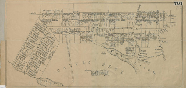
That New York City was once New Amsterdam and part of the Dutch North American empire is well known. Less so is the fact that in the 1600s, the East End of Long Island nearly became part of Connecticut. English immigrants seeking new opportunities or relief from religious oppression traveled across the Long Island Sound to the island’s eastern tip and formed settlements like Southold beginning in the 1640s. Early English Long Islanders desired independence and space, but nevertheless shared close cultural and even political ties with their New England neighbors.   

Southold’s original settlers, drawn to a strict interpretation of Puritanism, voluntarily placed themselves under the New Haven Colony’s political jurisdiction, paying taxes and even sending town representatives to the colony’s general court, William Wells among them. In the coming decades, these political allegiances became a source of conflict, first between the Dutch and the English, and, after 1664, between New York Colony and Connecticut Colony.
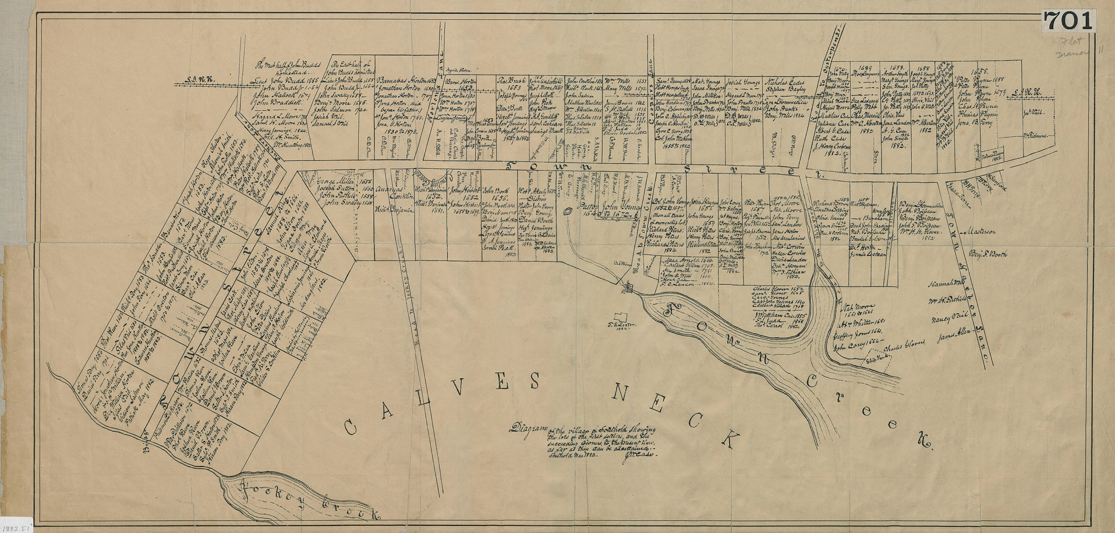
Diagram of the village of Southold, 1882

J.M. Case 

L.I.-1882.Fl

Brooklyn Historical Society

In the 1660s, a quick succession of upsets unsettled life in early Southold. First, in 1662, Connecticut Governor John Winthrop, Jr. secured a new royal charter for the colony, effectively absorbing New Haven Colony, including Southold on Long Island. William Wells apparently objected to the merger and refused to become a freeman of Connecticut Colony. However, the English conquest of New Amsterdam in 1664 presented an even bigger challenge to the future of the East End.
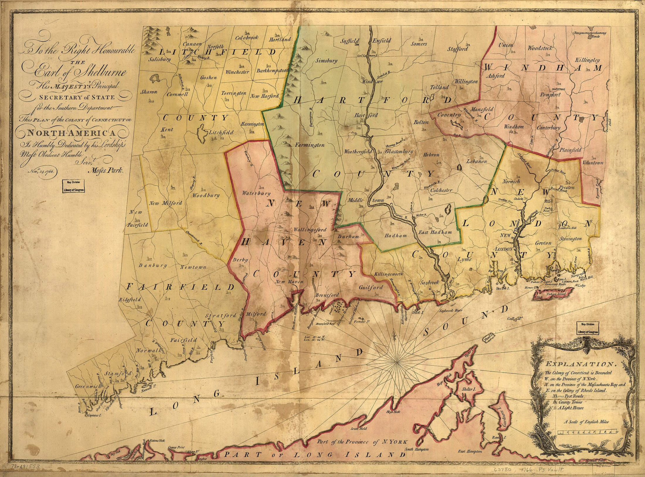
Plan of the Colony of Connecticut in North America, 1766

Moses Park 

G3780 1766 .P3

Library of Congress

Residents of the Long Island towns of Southold, Southampton, and East Hampton were apparently initially excited to see their Dutch rivals defeated. But for these East Enders, the possibility of losing some of the freedoms they had enjoyed under Connecticut rule turned them against New York swiftly. New York Governor Nicolls’ records document the persistent rebellion of the three East End towns, whose residents refused to elect local officials or to “pay the publique Rates,” or taxes. 

This resistance continued into the 1670s, when the Dutch briefly recaptured the region, renaming it New Orange and demanding the obedience of all residents, including those on Long Island. Sensing a final opportunity, the East End towns reached out to Connecticut officials pleading for protection and to reestablish their former political ties with the colony. Ultimately, the Dutch takeover failed, and the 1674 Treaty of Westminster gave New York back to England, whose jurisdiction over Long Island was then cemented.
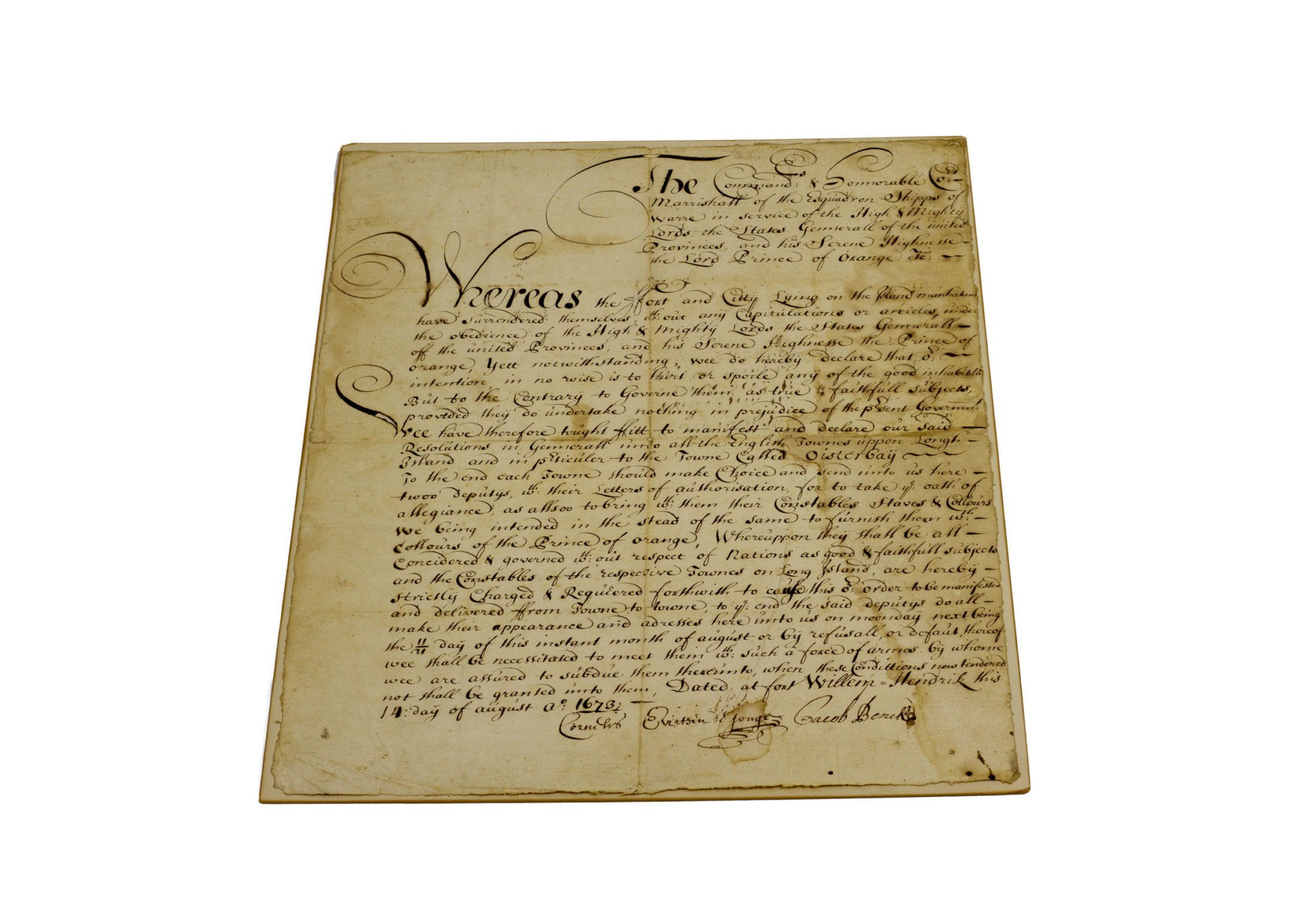
Order of Allegiance to the United Provinces and Prince of Orange, 1673

Townsend family papers (1974.021)

Brooklyn Historical Society

Eastern Long Islanders’ hostility to New York was resolved by the colony’s third governor, Edmund Andros. He issued generous new land patents to the townships and promised to respect their control of their local common lands. Imagine, though, how different Long Island might be today if the island had been divided between New York and Connecticut.
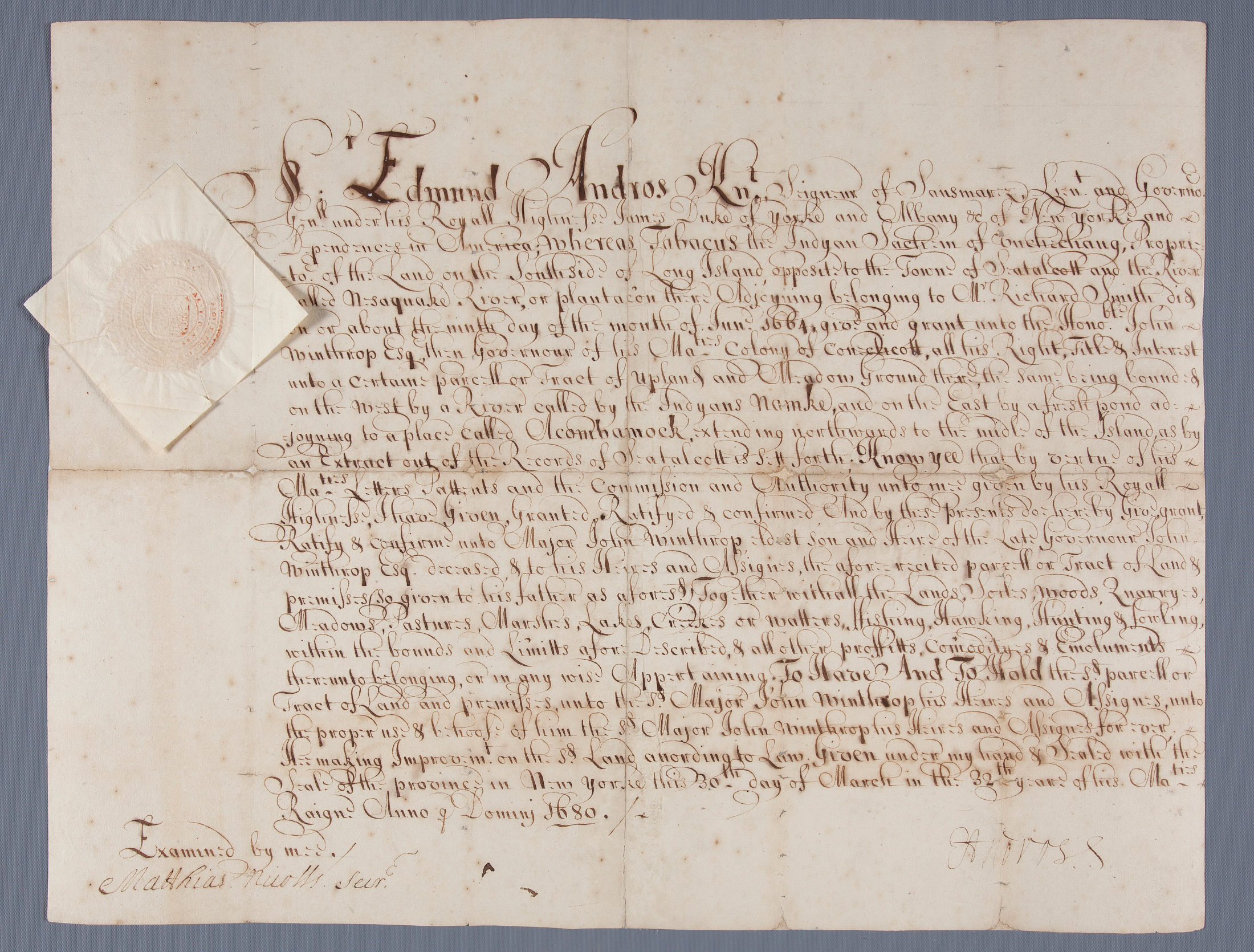
East Riding Land patent, 1680

Governor Edmund Andros 

Robert C. Winthrop collection (1974.052)

Brooklyn Historical Society
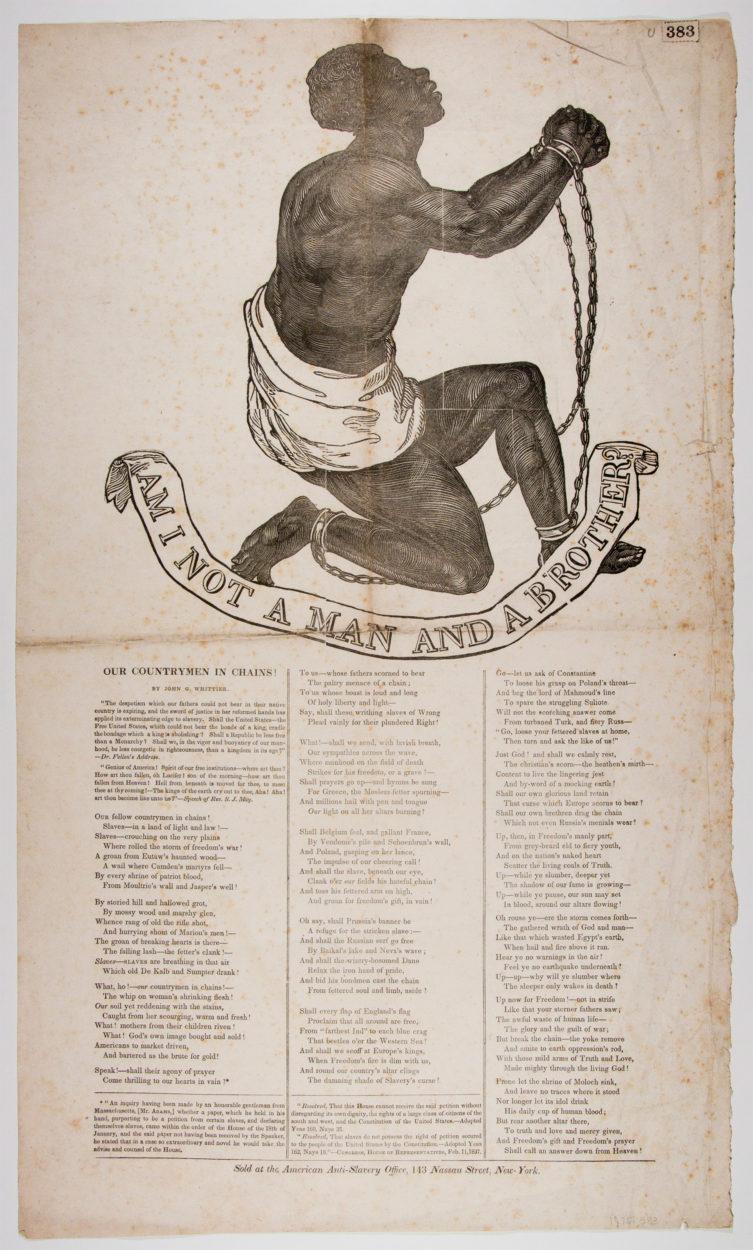
“We set off for Long Island”

Witnessing Tragedy in Early Breukelen

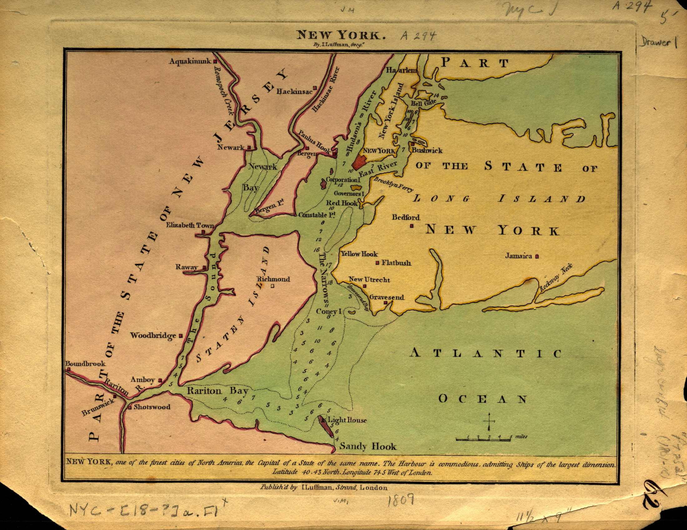
When they crossed the East River in 1639, Anthony Van Salee and his family were among the first European settlers to establish permanent homes on Long Island, New Amsterdam’s neighboring frontier. The first purchase of land in western Long Island had taken place just three years earlier, by Dutch West India Company officer Jacob Van Corlaer. 

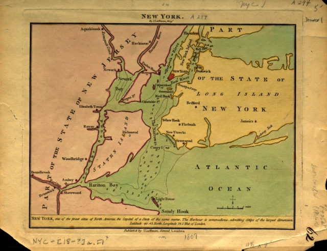
More people followed. The Dutch government approved the incorporation of several towns: Gravesend (1645), Breucklen (Brooklyn, 1646), Flatlands (1647), Flatbush (1651), New Utrecht (1657), and Bushwick (1660). Van Salee’s land eventually fell near the two most southernmost villages, Gravesend and New Utrecht.

New York, 1809

I. Luffman Strand

NYC-[18-?]a.Fl

Brooklyn Historical Society

The lands that individuals like Van Salee claimed as their own were not unoccupied. Long Island was part of the territory of the Lenni Lenape, American Indian communities who called the island Sewanhacky and lived along its waterways. Little information survives today about Lenape life in the 1600s. Limited archaeological evidence and European accounts, which must be scrutinized with a critical eye for bias, provide few details about their lives.

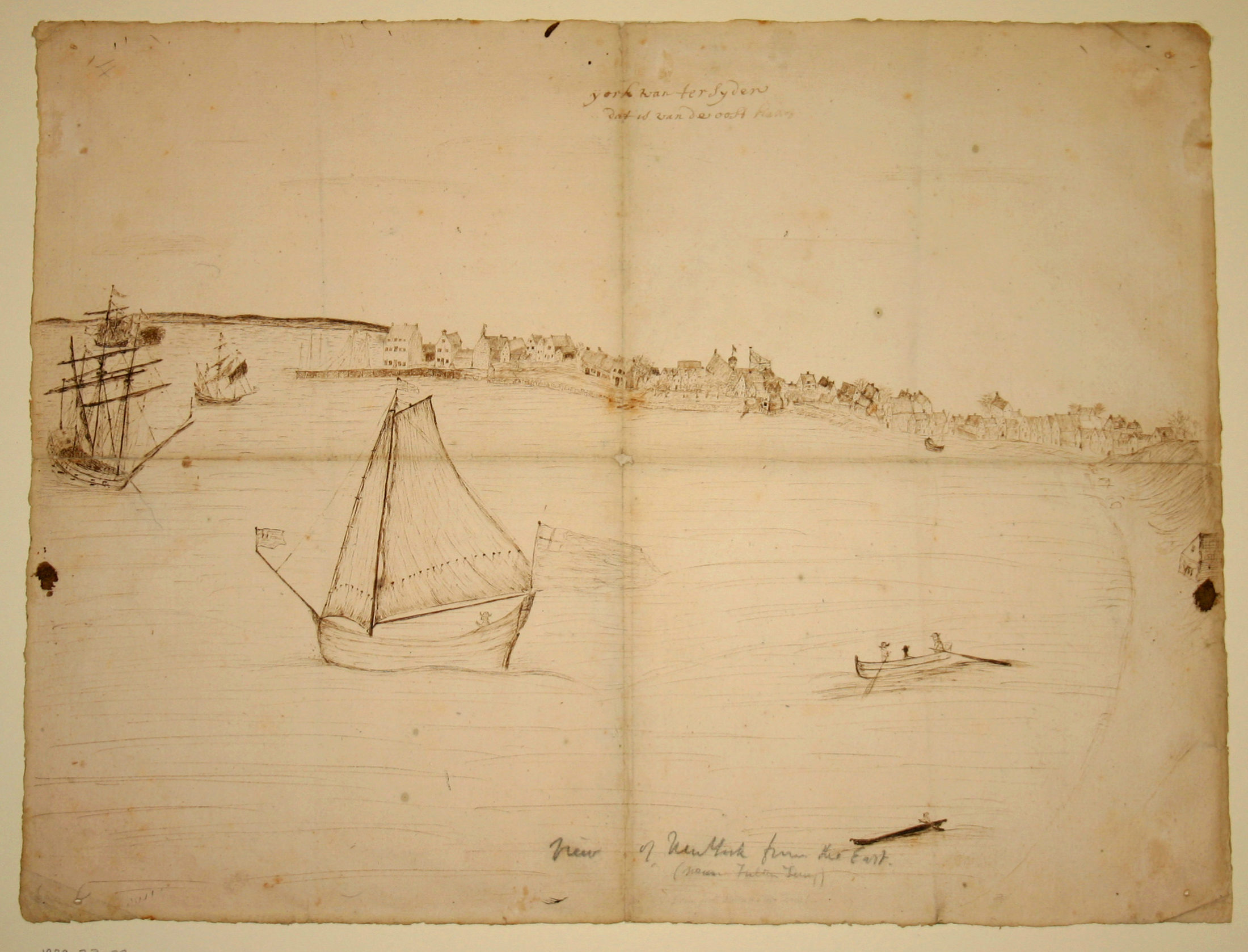
View of New York from the North (near Fulton Ferry), 1679

Jasper Danchaerts

M1979.23.4

Brooklyn Historical Society

Dutch Labadist priest Jasper Danckaerts visited New York and Long Island in 1679, part of an extensive journey across North America in search of a potential location to establish his religious sect. He kept a detailed dairy of the trip, beginning from the moment of his departure from Holland, at 4 a.m. During the journey across the Atlantic, Danckaerts became acquainted with some New York residents, including Gerrit Cornellissen Van Duyn, who made introductions for Danckaerts in Manhattan and Long Island when they arrived in September 1679.

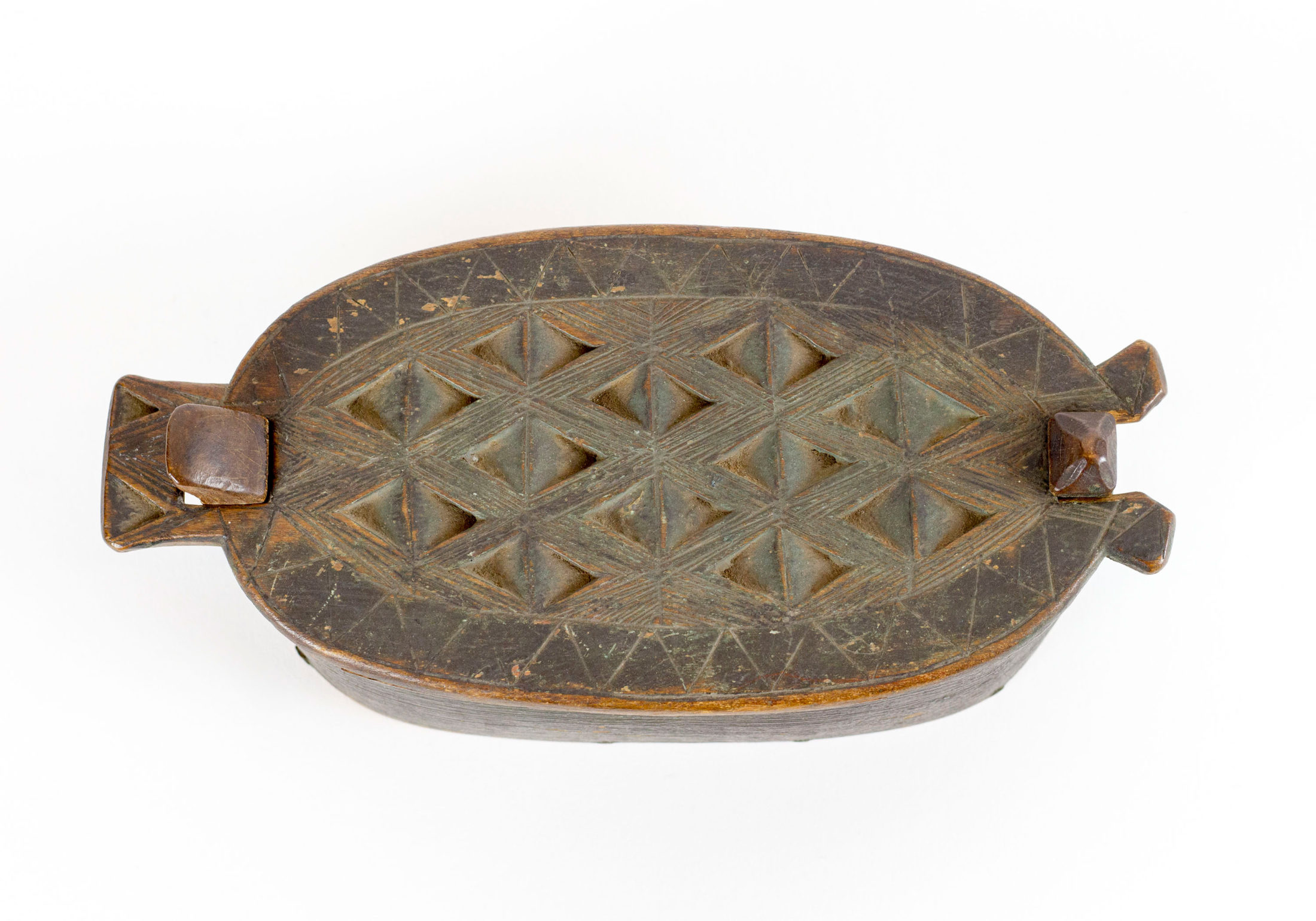
Bentwood Box, 17th century or later

M1984.320.3

Brooklyn Historical Society

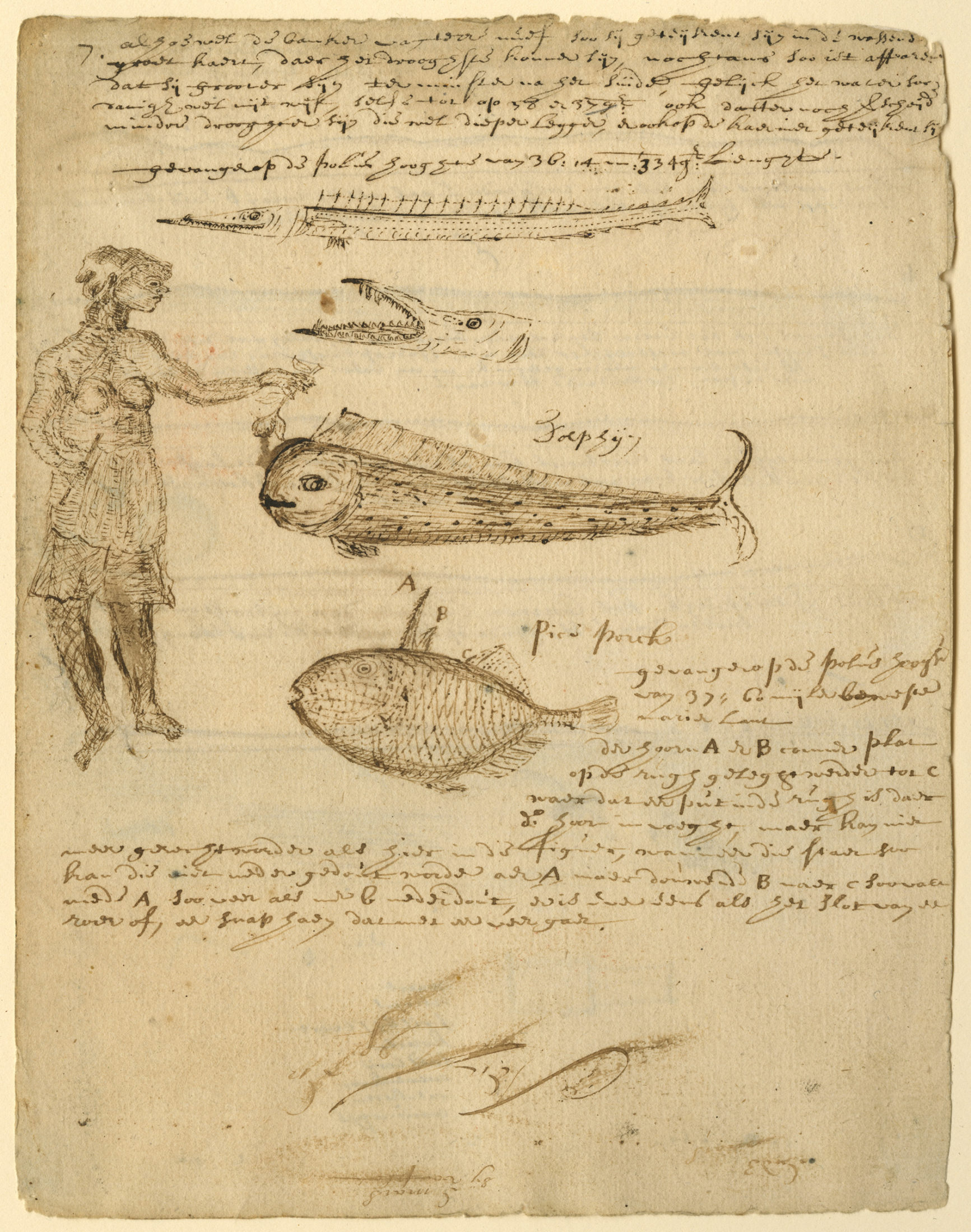
Invited into an American Indian longhouse, Danckaerts recorded with interest details of the building’s structure and the family dynamics and meals. His accounts also include glimpses into the misunderstandings that had devastated the Lenape population by the end of the century. Danckaerts noted conflicting understandings about land ownership between Van Duyn’s brother-in-law and the local Lenape from whom he had purchased “the whole of Najack.” Jacques Cortelyou, Van Dun’s brother-in-law, considered himself the sole owner of this land. His indigenous neighbors continued working certain farm plots, a sign to them that the land was communal. On a visit to a neighboring Indian settlement, Danckaerts saw many children sick with smallpox, “the most prevalent disease in these parts, and of which many have died.” We know now that the Lenape did understand the power of land purchase, but they did not realize the reach of English and Dutch power and their control over these land deals.

American Indian woman with fish, 1689

Jasper Danckaerts

M1979.23.1

Brooklyn Historical Society

By 1684, mere years after Danckaerts’ visit to the region, the last of American Indian land in Brooklyn had been “transferred” to European settlers by American Indian sachems. Loss of land, European diseases, and warfare decimated the American Indian population by the late 1600s, reducing it to perhaps one-thirtieth of what it had been in the 1630s.

America’s First Commuter Suburb

Brooklyn Heights and the Tobacco Shop at 78 Montague Street

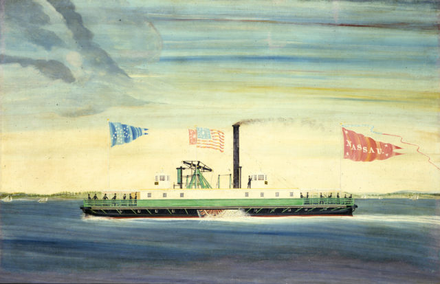
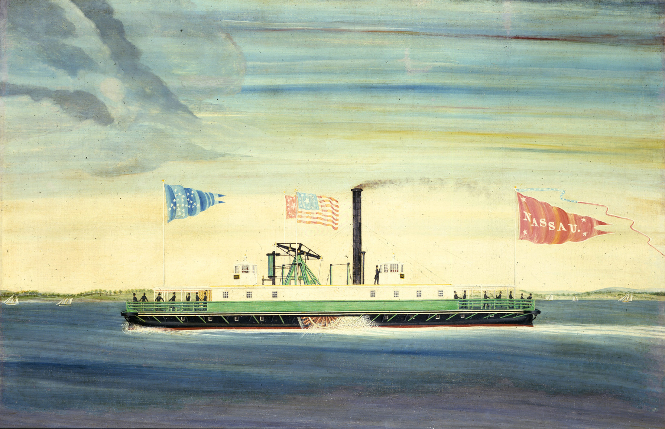
BHS’s seated Indian show figure looked out onto Brooklyn Heights from the tobacco shop at the corner of Montague and Hicks Street for seventy years, from 1860 to 1930. Sweeping changes redefined the neighborhood in this period. In 1814, the launch of the first commercial steam ferry from the nearby Brooklyn waterfront attracted the attention of residential developers. By the 1830s, Brooklyn Heights had become “Manhattan’s first commuter suburb,” its streets lined with opulent mansions that overlooked the East River. Thirty years later, the arrival of businesses like the tobacco shop at 78 Montague Street marked the Heights as a commercial hub.

Steamboat Nassau, before 1849
John and James Bard
M1974.100.1
Brooklyn Historical Society

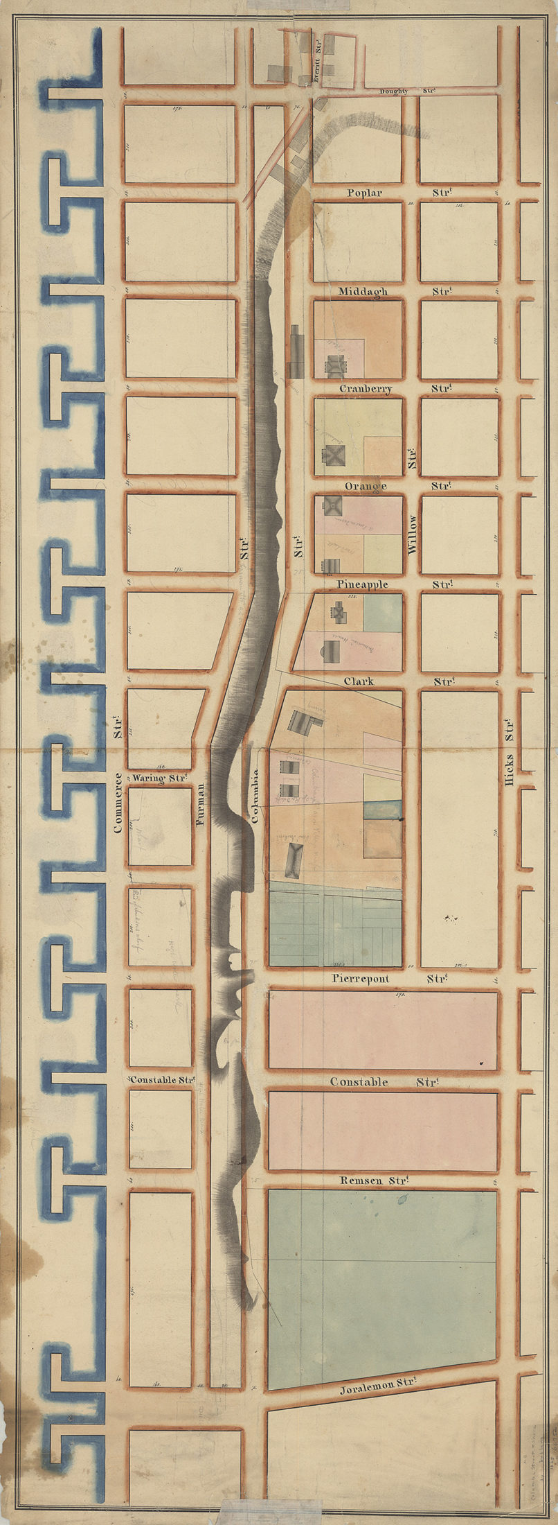
Columbia Street & Shore, 1825
Silas or Isaac T. Ludlam
B P-1825.Fl
Brooklyn Historical Society

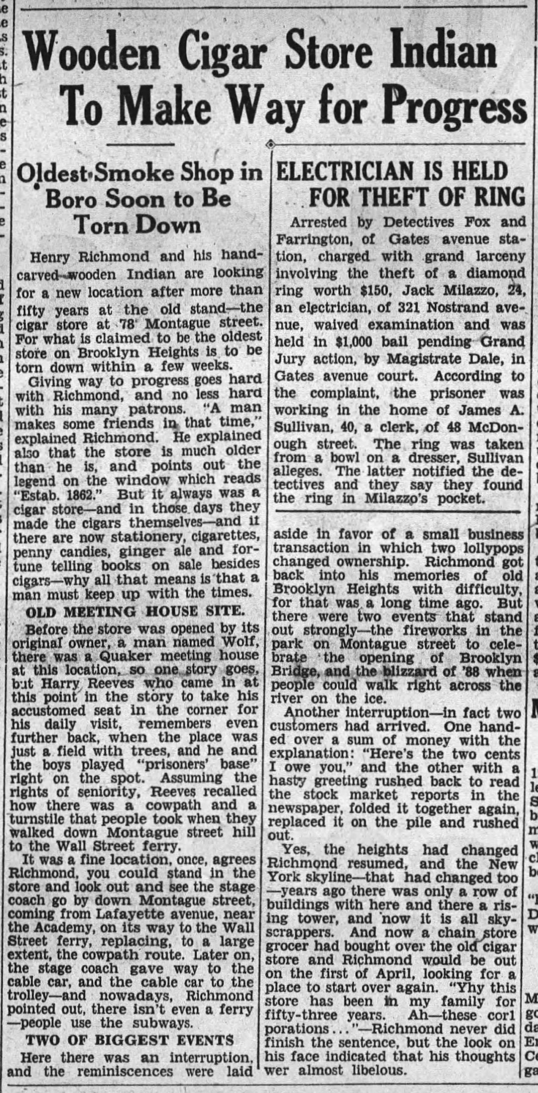
The Montague Street tobacco shop changed owners at least four times between 1862 and 1930. All of its proprietors were immigrants. John R. Wolff and August P. Humburger, both German, operated the business before it was purchased by Englishman George Richmond in 1879. Richmond’s son Henry was the store’s final owner before it closed in 1930. As Henry Richmond himself told a reporter from the Brooklyn Standard Union, his store was “giving way to progress,” his business drying up as larger retailers and grocery stores moved into Brooklyn.

Advertisement for tobacco and cigar store at 78 Montague Street
New York Daily Herald, March 26, 1871

For longtime residents of Brooklyn Heights, the shuttering of the Montague Street tobacco shop marked the end of an era. Despite the figure’s caricature of American Indians in Brooklyn, residents missed the Indian in their neighborhood landscape. For many the carving had been present their entire lives. The seated Indian became the focus of nostalgia for supposedly simpler times, “one of the remaining relics of the days when the Heights was little more than a glorified New England village.” Henry Richmond left Brooklyn Heights in 1930, but his show figure remained, purchased by locals and donated to Long Island Historical Society (now Brooklyn Historical Society).

“Wooden Cigar Store Indian to Make Way for Progress”
Brooklyn Standard Union, March 12, 1930

“Our land will then take such a rise”

The Growth and Suburbanization of Queens County

Bloodgood Haviland Cutter was the descendant on both sides of his family from some of Queens County’s earliest European settlers, granted land in the region in the 1600s by Dutch governor Willem Kieft. When the English government formally incorporated Queens County in 1683, it was home to five small townships: Newtown, Flushing, Jamaica, Hempstead, and Oyster Bay. Like the rest of Long Island, Queens was sparsely populated and its economy centered on farming and agriculture driven by enslaved workers. In 1790, less than 5,400 people lived in Queens, including 1,095 enslaved people.

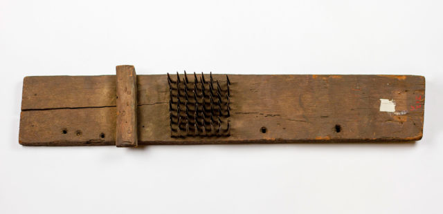
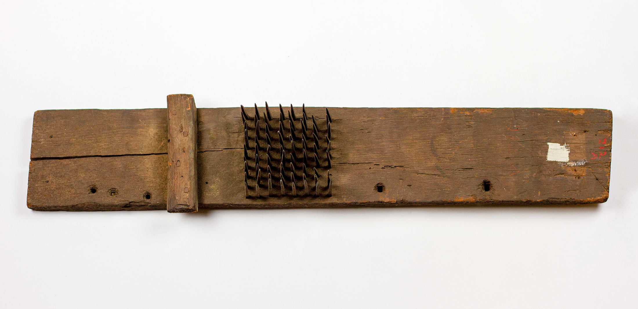
Hatchel, 18th century 

Made in Newtown, Queens County, Long Island

M1991.456.1

Brooklyn Historical Society

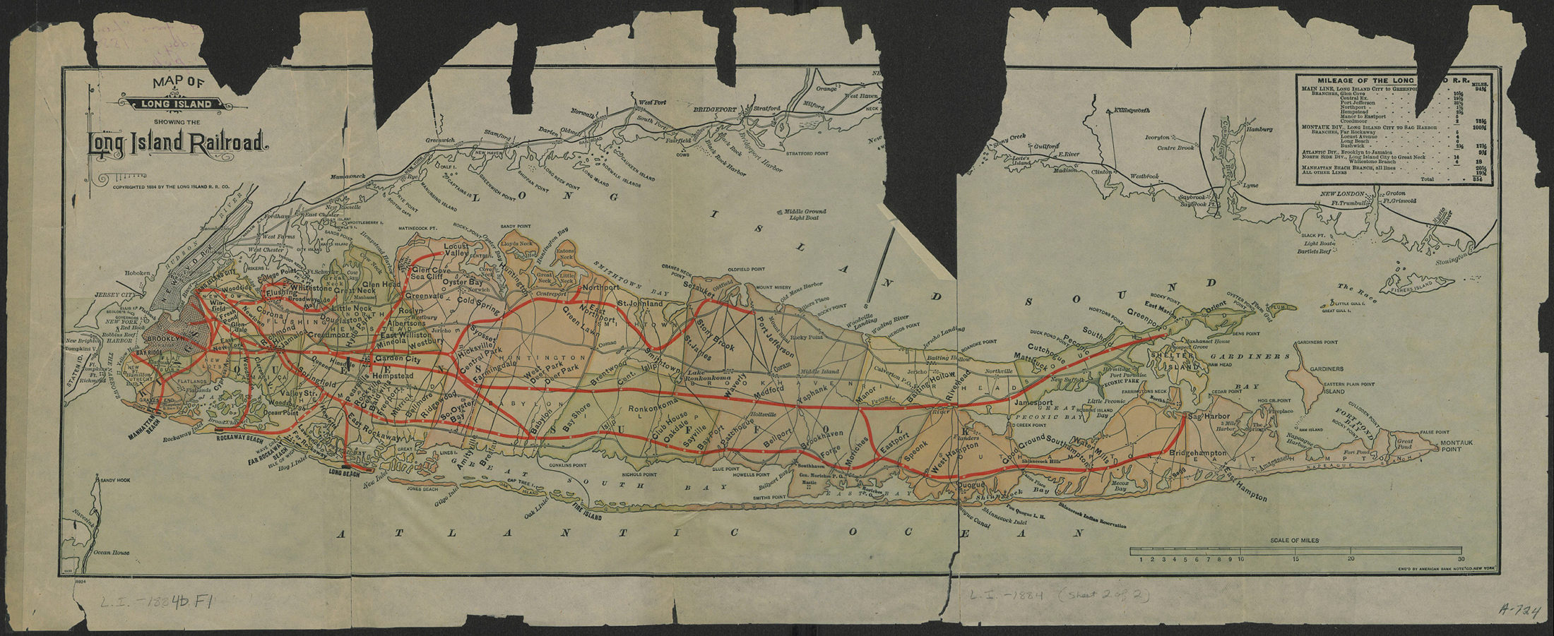
Queens remained largely rural well into the 1800s, but the introduction of railroads jump-started its transformation. The first tracks of the Long Island Railroad were laid in 1836 and connected Brooklyn to Jamaica, Queens. In the next decades, competing railroad corporations pushed rail lines farther east onto Long Island.

Map of Long Island showing the Long Island Railroad, 1884

Long Island Rail Road American Bank Note Company 

L.I.-1884b.Fl

Brooklyn Historical Society

Cutter’s poetic musings provide evidence of his avid interest in railroads. He invested in several, including the Long Island Rail Road Company and the North Shore Railroad Company, the latter organized in 1863 to build tracks east from Flushing towards Great Neck. In his poem “North Side Railroad,” Cutter enthusiastically cried out: 

Come out, my friends, and now subscribe
To build a road on the North Side,
If each will only do his part,
We soon will see the railroad start.

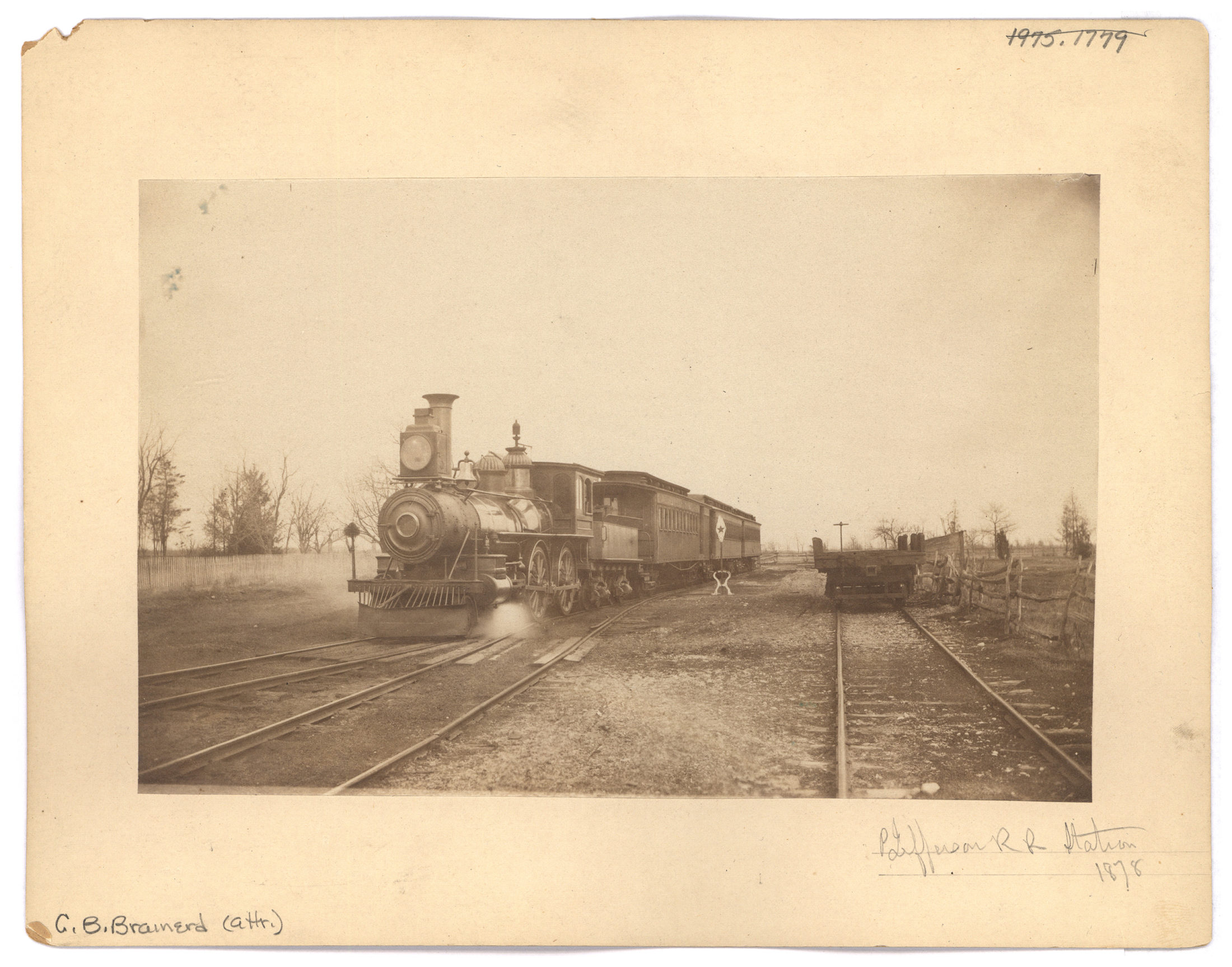
Port Jefferson Rail Road Station, 1878

George B. Brainerd

V1972.1.197

Brooklyn Historical Society

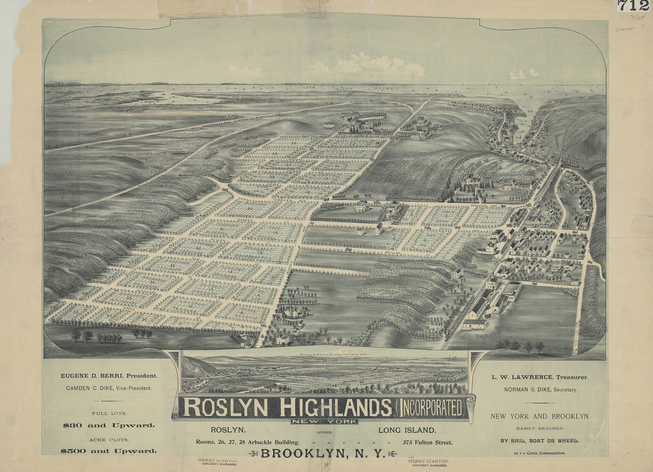
Improved transportation options in the second half of the 1800s led to a boom in land speculation in Queens and the construction of new communities. Many new residents were attracted to Queens because they were searching for a suburban retreat from the growing congestion of New York City.

Roslyn Highlands Incorporated, New York, after 1892

L.I.-[189-?]a.Fl

Brooklyn Historical Society

While Bloodgood Cutter’s quaint “Long Island Farmer Poet” image contradicts his status as a shrewd venture capitalist who increased his wealth by investing strategically. In his poem “North Side Railroad,” Cutter summed up the risk and rewards of investing in Long Island’s railroads. 

Our land will then take such a rise,
‘Twill us agreeably surprise…

Then citizens will out remove,
And then the North Side will improve;
How much better that will pay,
Then raising either corn or hay. 

Then if you wish to sell your land,
Can get the chink right in your hand;
And then if you desire more ease;
Can work or play, just as you please.

“Pleased that he is a New Yorker”

Bloodgood Cutter, Greater New York, and the Birth of Nassau County

From his Little Neck farm sixteen miles northeast of Manhattan, Bloodgood Cutter witnessed the great debate over the consolidation of Greater New York, which was decades in the making but at its fever pitch in the 1890s. Cutter seems to have left no poetic remembrance related to it despite the enormity of the event. Nevertheless, his likely perspective on consolidation becomes clear through his political and personal interests and provides insight from the region that eventually became the far eastern edge of Greater New York City.

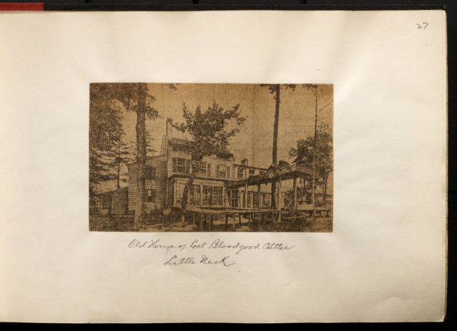
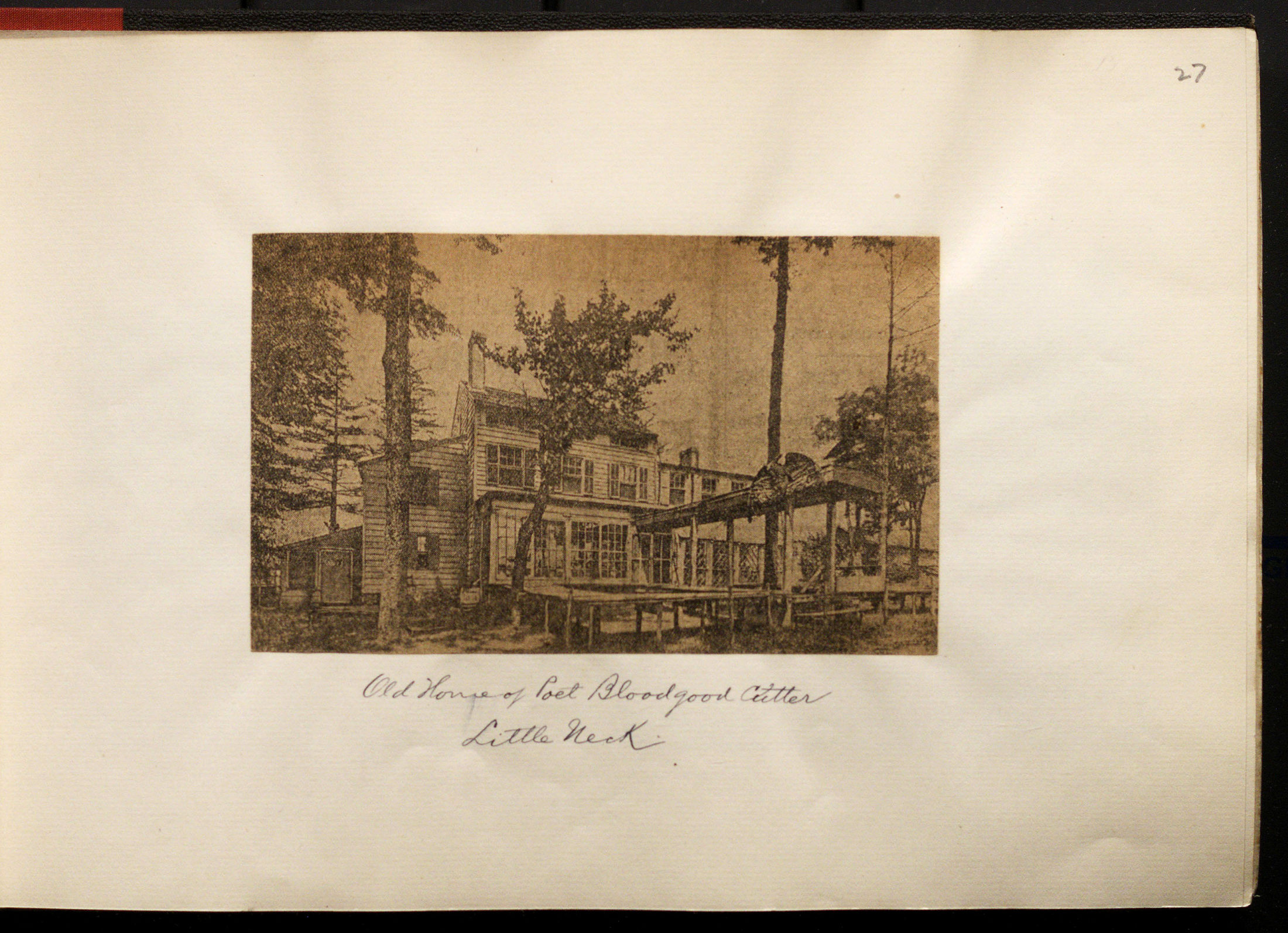
Old home of Poet Bloodgood Cutter, Little Neck, 1909

Eugene L. Armbruster photographs and scrapbooks (V1974.022.14.030)

Brooklyn Historical Society
Following the Civil War, the region around New York Bay experienced unprecedented economic and population growth. For many area entrepreneurs, the financial benefits were stymied by internal competition and clashing municipal governments. With promises that consolidation could increase tax revenue, improve land values, and end boundary disputes, boosters rigorously campaigned to consolidate the region under a united municipal government, one to oversee New York City, Brooklyn (Kings County), Queens County, parts of Westchester County, and Staten Island. After decades of petitioning and a public vote in 1894 that passed but was squashed in Albany, the state approved consolidation in 1897. The City of Greater New York, more than 300 square miles and 3 million residents strong, came into existence on January 1, 1898.

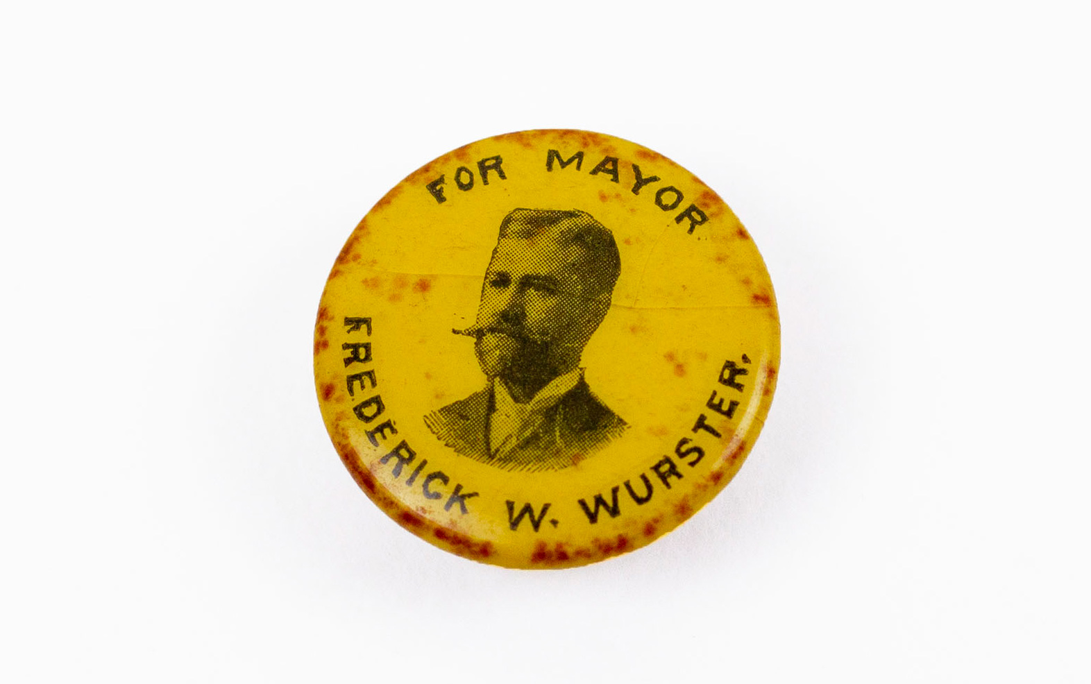
Frederick W. Wurster mayoral campaign button, 1896

M1991.415.1a,b

Brooklyn Historical Society
Following consolidation, newspaper publishers around the country described Bloodgood Cutter, “the farmer poet of Long Island,” as “much pleased over the fact that he is now a citizen of New York.” As an extensive property holder and a supporter of modernization efforts like laying new railroad tracks that connected eastern Queens County to New York, Cutter saw great potential personal reward in consolidation.

Atlas of Long Island, New York, 1873 

Frederick W. Beers 

New York Public Library Digital Collection

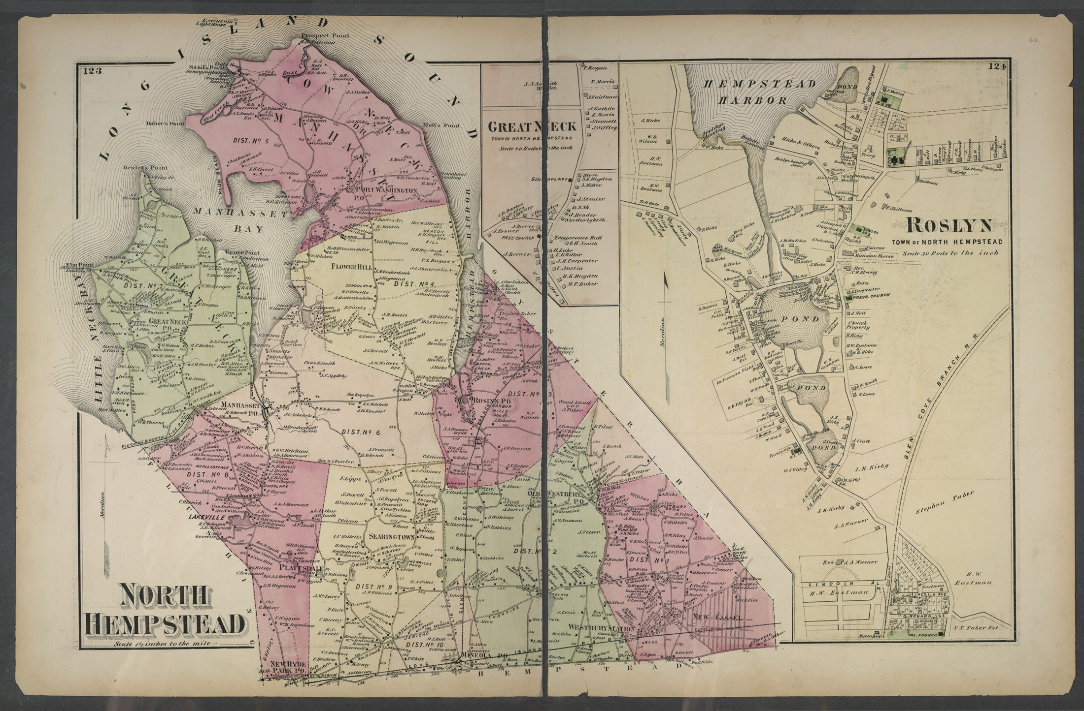
Cutter’s property, encompassing the southern tip of Little Neck Bay between Flushing and North Hempstead, was very close to the city’s new borders. Consolidation tore Queen’s County in half. The towns closest to Manhattan—Long Island City, Newtown, Flushing, and Jamaica—joined Greater New York. The eastern towns of Hempstead, North Hempstead, and Oyster Bay did not. On January 22, 1898, the citizens of the latter towns met to discuss their future.

Image Missing

[E09 tombstone]
Nassau County, New York, 1906
L.I.-[19–?].Fl
Brooklyn Historical Society

Residents of the farther, disputed areas in Queens debated joining either New York City or Suffolk County. Ultimately, they decided to become a new county, Nassau County, “for the simple reason that they could govern themselves, and their interests were identical.” Nassau County was born January 1, 1899. As the 1906 map of Nassau County shows, New York City annexed Cutter’s property into Flushing, creating a cut into North Hempstead in an effort to control the ports on the Bay. Bloodgood Cutter became a New Yorker.